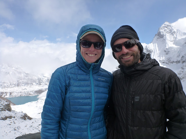
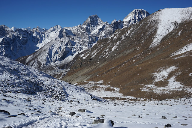
In November 2008, Marie and I came to Nepal for a trek to Everest Base Camp on our honeymoon. That trip was one of our most memorable travel experiences and during our year off I knew we had to come back at some point! The months of October and November in Nepal have amazing weather, and not surprisingly also happen to coincided with peak trekking season. The monsoon is over, the weather is stable, and the skies are crystal clear with very little rain. After a lot of research, we decided to return to the Khumbu region once again. One of the major reasons for going back to the same area is that due to the large number of villages in the region, and established trekking infrastructure we could tour the region on our own without guide or porter, staying in "teahouses" as we went. We would hardly need to bring any gear with us - only our warm clothes and sleeping bag. All our food and shelter we would sort out along the way. Doing it on our own also really helped to keep the costs down. Due to the popularity of trekking in the region, the prices of guided tours has really gone up - we looked around and even going with a local company (the same one we used seven years ago) the cost was going to be around $1800USD/person for a three week trek (not including tips)! The price would be even more if we decided to go to a more remote area where camping was required since this meant horses, more staff, kitchen gear etc. We both agreed that this time around we wanted the extra challenge - routefinding on our own, carrying our own gear, and travelling at our own pace. Since we were going back for a second time, we also wanted to see something different so we opted for the ultimate circuit of Sagarmatha National Park: a 120km round trip of the region that would cross three glaciers, and three passes over 5000m. We would first fly into the notoriously dangerous Lukla airport (with ridiculously short inclined runway), and then hike two days to reach Namche Bazaar and the start of the circuit. From here we would would hike NW up to the village of Thame, up over the Renjo La pass (5350m), down to cross the Ngozumpa glacier by Gokyo, climb up over Cho La pass and glacier (5450m), down again to cross the Khumbu glacier, and lastly up and over the Kongma La pass (5550m). From here we would complete the loop by heading back to Namche Bazaar and eventually Lukla for our flight out. In order to acclimatize properly we set a relaxed schedule and planned for 21 days (18 days of trekking plus 3 contingency for sickness or weather).
WARNING: The following post is really long, but you can just scroll through the pictures instead to get the gist!
Day 1:
We were back on the plane we vowed never to take again. The flight to Lukla airport is by visual aids only - there are no fancy electronic features at this airstrip such as radar, and lights. As a result, the flights here get cancelled all the time since the pilots can't land if they can't see the runway (at least there are some safety standards in Nepal). The landing is a bit terrifying since you are literally flying into the side of a mountain. The airstrip is perched on the only tiny bit of flat-ish land around, and is actually inclined upwards to help the plane slow down this ridiculously short runway. Luckily we managed to get on the first flight of the day which meant that there would be a good chance that we would be able to fly in before the daily afternoon clouds rolled in.
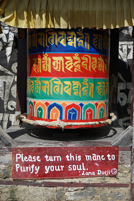
Made it! From here we hiked a couple of hours down the valley through several small villages, past Buddhist Mani walls and prayer wheels to the town of Phakding.
Day 2:
WARNING: The following post is really long, but you can just scroll through the pictures instead to get the gist!
Day 1:
We were back on the plane we vowed never to take again. The flight to Lukla airport is by visual aids only - there are no fancy electronic features at this airstrip such as radar, and lights. As a result, the flights here get cancelled all the time since the pilots can't land if they can't see the runway (at least there are some safety standards in Nepal). The landing is a bit terrifying since you are literally flying into the side of a mountain. The airstrip is perched on the only tiny bit of flat-ish land around, and is actually inclined upwards to help the plane slow down this ridiculously short runway. Luckily we managed to get on the first flight of the day which meant that there would be a good chance that we would be able to fly in before the daily afternoon clouds rolled in.
 |
| Lukla Airstrip |
 |
| Momos and Sherpa stew |
Still on the main trail, we hiked up to Namche Bazaar along with dozens of yak trains and porters carrying supplies up to the main market that serves the entire Khumbu region. Since China closed the Nepal-Tibet border here a couple of years ago, all goods are now carried in along this one route (not to mention all the trekking and climbing gear) which makes for one dusty and chaotic walk.
Our first view of the Himalayas peaking up out of the steep walled valley.
Some of these porters are inhuman, carrying up to 100kg in a single load! They have my respect - I was struggling with the altitude and I was only carrying 15kg!
Finally, after crossing several suspension bridges we reached Namche Bazaar (3500m), the center of activity for the entire region. The town is shaped like an amphitheatre and is perched up high above the valley below. Since we had last visited seven years ago there have been many changes - most notably the construction of a micro-hydro power plant which now supplies the town (and other surrounding villages) with electricity. Of course, with electricity also comes all of the comforts of home - hot water, bakeries, and 3G cell service! Wow.
Day 3:
In order to help acclimatize to the altitude, we spent an extra night in Namche and took a day hike up to some of the small villages higher up the valley. The small hamlets of Kunde and Kumjung (3800m) are both thriving communities and have benefited significantly from all the climbing in the area - most houses are owned by climbing Sherpas. There is even a well equipped hospital (apparently with MRI machine and funded by the Sir Edmund Hillary Foundation of Canada!) and high-school!
Day 5/6:
We woke up the next morning to a blanket of snow - apparently the first snowfall of the season (what luck!). At this point we had a bit of a dilemma. We were down near 4000m elevation and there was a ton of snow. What would the conditions be up on the Renjo La pass which was well over 5000m? We decided to wait it out and see what happened. We still had two more nights of acclimatization before we attempted the pass, and hopefully the snow would stop soon. The next night we would spend in Maralung (4200m), and the night after at Lungden (4400m), the last town before the pass.
The snow fell continuously for an entire day, and we saw several groups turning around due to the weather. The advantage we had of not being on a guided tour was that we didn't have to adhere to any schedule - we decided instead to just wait it out. Lucky for us over the course of the next two days the weather continuously improved and the views of the snow covered peaks were spectacular.
Day 7:
It's go-time. The weather cleared up and we decided to head up over the Renjo La pass (5350m) since we could now actually see where we were going. At 6am in the morning it was damn cold.
Day 7:
We decided to spend one whole day in the Gokyo valley, and explore up the valley along the Ngozumpa glacier. There are six lakes here in a spectacular setting with Cho Oyu (8200m) looming in the background. The glacier here is one of the largest in the world (and the largest in the Himalayas) at 36km long. It is very different from the glaciers we have back home in the Coastal mountains of B.C.. Instead of ice and snow, it is more of a giant conveyor belt of rubble. In fact, unless you look really closely you can't see any ice at all - just undulating piles of boulders.
Day 8/9:
The next goal was to cross the second major pass of the trip: Cho La (5450m). First we made the short trip across the Ngozumpa glacier (shown above) to the town of Tagnak which is hiding just behind the moraine on the far side of the glacier (opposite Gokyo). Although it looks close, it took more than 2 hours to negotiate the piles of rubble on the glacier. We even managed to find some ice under all that rock!
The next morning we got a 6am start, and headed up the valley towards the Cho La pass. The climb was relatively straightforward, but still took us about 3 hours to the top since we were carrying quite a bit of weight in our backpacks (not to mention we were hiking at more than 5km above sea-level!) However, we did feel a lot stronger than the last pass and figured that we were finally starting to get used to the altitude.
The back side of the pass was a bit icy, but lucky for us some Sherpas setup a fixed line to the glacier below.
Over the next two days we hiked at lightning speed back down to Lukla to catch our flight. We both felt like superheros at this point - after spending almost two weeks at altitudes greater than 4500m the air down at Lukla at 2500m felt so thick and luxurious.
Our first view of the Himalayas peaking up out of the steep walled valley.
Some of these porters are inhuman, carrying up to 100kg in a single load! They have my respect - I was struggling with the altitude and I was only carrying 15kg!
Day 3:
In order to help acclimatize to the altitude, we spent an extra night in Namche and took a day hike up to some of the small villages higher up the valley. The small hamlets of Kunde and Kumjung (3800m) are both thriving communities and have benefited significantly from all the climbing in the area - most houses are owned by climbing Sherpas. There is even a well equipped hospital (apparently with MRI machine and funded by the Sir Edmund Hillary Foundation of Canada!) and high-school!
 |
| Another abandoned airstrip above the city of Namche |
 |
| Dried yak dung is the only readily available source of fuel |
 |
| Town of Kumjung |
Day 4:
From Namche we began our circuit of the park heading NW towards the town of Thame (3800m). The scenery was beautiful but we also noticed that the clouds were looking a bit more dark and ominous. Probably nothing... the clouds were always rolling in during the afternoons. |
| Thame |
 |
| Winter fuel stock-pile |
We woke up the next morning to a blanket of snow - apparently the first snowfall of the season (what luck!). At this point we had a bit of a dilemma. We were down near 4000m elevation and there was a ton of snow. What would the conditions be up on the Renjo La pass which was well over 5000m? We decided to wait it out and see what happened. We still had two more nights of acclimatization before we attempted the pass, and hopefully the snow would stop soon. The next night we would spend in Maralung (4200m), and the night after at Lungden (4400m), the last town before the pass.
The snow fell continuously for an entire day, and we saw several groups turning around due to the weather. The advantage we had of not being on a guided tour was that we didn't have to adhere to any schedule - we decided instead to just wait it out. Lucky for us over the course of the next two days the weather continuously improved and the views of the snow covered peaks were spectacular.
 |
| Marie enjoying the warm common-room of our teahouse in Lungden |
It's go-time. The weather cleared up and we decided to head up over the Renjo La pass (5350m) since we could now actually see where we were going. At 6am in the morning it was damn cold.
 |
| Almost at the top! |
 |
| Mandatory summit shot |
 |
| Gokyo - our rest stop for the night after a really long and hard climb! |
We decided to spend one whole day in the Gokyo valley, and explore up the valley along the Ngozumpa glacier. There are six lakes here in a spectacular setting with Cho Oyu (8200m) looming in the background. The glacier here is one of the largest in the world (and the largest in the Himalayas) at 36km long. It is very different from the glaciers we have back home in the Coastal mountains of B.C.. Instead of ice and snow, it is more of a giant conveyor belt of rubble. In fact, unless you look really closely you can't see any ice at all - just undulating piles of boulders.
 |
| Tibetan Snowcock getting sassy |
 |
| Cho Oyu (8200m) is the peak in the background - apparently the "easiest" 8000m+ mountain climb |
 |
| The Ngozumpa glacier seems to go on forever... |
 |
| Mt. Everest (center) from the "Scoundrel's Viewpoint" - this is the only place in the region where you can actually see the whole mountain (apart from actually climbing something nearby) |
For some extra kicks, we decided to also climb up to the top of Gokyo Ri (5350m) which is really no more than a slog up a scree pile for 600m. But it did offer some great views of the town of Gokyo and the surrounding mountains.
 |
| Gokyo town is squashed in between the lake and the lateral moraine of the glacier |
 |
| Mt. Everest peaking up over all the rest (top-left) |
The next goal was to cross the second major pass of the trip: Cho La (5450m). First we made the short trip across the Ngozumpa glacier (shown above) to the town of Tagnak which is hiding just behind the moraine on the far side of the glacier (opposite Gokyo). Although it looks close, it took more than 2 hours to negotiate the piles of rubble on the glacier. We even managed to find some ice under all that rock!
 |
| Middle of the Ngozumpa glacier |
 |
| Yak parking in Tagnak |
 |
| View back down the valley on our way up to Cho La |
 |
| Cho La pass is the notch in the middle |
 |
| Summit shot |
 |
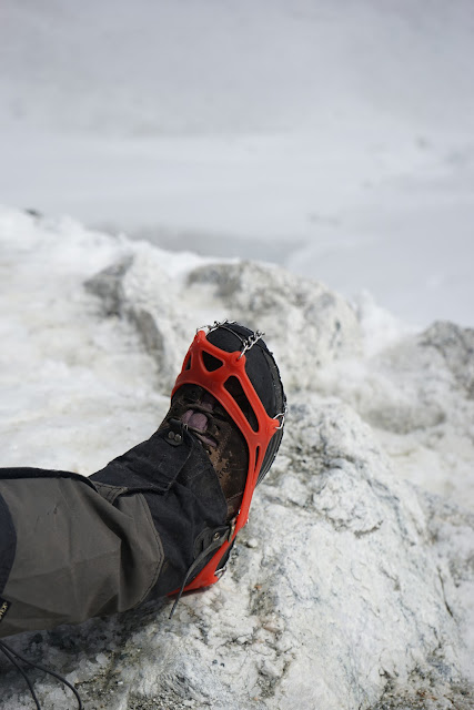
| Crampons for the way down the Cho La glacier |
 |
| Some "hand repelling" |
 |
| Cho La glacier |
 |
| Amazing views of Ama Dablam (6800m) as we descended down to the town of Dzongla |
 |
| Drying out at Dzongla (4800m) |
Day 10/11:
At this point we debated where to go next. We could either head directly towards the third and final pass of the trip or take a side-trip up to Everest base-camp. Since we had already been there seven years ago (and speaking frankly, there is nothing really to see there - even the views are not very good), we decided to simply go up to the village of Gorek Shep (5100m) stay the night and climb Kala Patar (5600m) instead (where the views are spectacular). Gorek Shep is the last settlement before Everest base camp and sits just below the moraines of the Lobuche and Khumbu glaciers. In my opinion it is a bit of a soulless town with massive lodges that exist for the sole purpose of providing a place to stay for the thousands of tourists who come each month to the area to visit base-camp. There is no sense of community like other villages in the area, and here it's all about business and making money - but it is a very convenient place to spend the night.
 |
| Leaving the town of Dzongla - the small settlement shown above on the knoll |
 |
| Ama Dablam towering over Dingboche |
 |
| Walking alongside the Khumbu glacier |
 |
| Gorek Shep (5100m) |
 |
| They even have a cell tower with 3G powered by a large solar array! Things have changed since we were here seven years ago. |
That evening we climbed Kala Patthar, which is a hill directly behind Gorek Shep and is essentially a big pile of black rubble (the name in Hindi also means something along those lines). Again it was a slog to the top, but provided some amazing views of Nupse (7800m) and of course Everest which is the tallest at 8800m. We were a bit worried as we climbed up in the afternoon as the clouds were rapidly rolling in; however, it turned out that the clouds were actually just low valley clouds and once on the top of Kala Patthar we could still watch the spectacular sunset.
 |
| Only the largest mountains in the Khumbu valley peak out from the clouds |
 |
| Ama Dablam |
 |
| Last rays of the days sun hitting the highest mountain in the world |
Day 12/13:
The next day we had an easy walk back down the valley to Lobuche (4800m) where we spent the night and prepared for our early morning start the next day. At 5am we woke, had a quick breakfast and set out across the Khumbu glacier towards our final high pass of the trip: Kongma La (5550m). It was a very cold morning - probably the coldest we had experienced on our trip so far. Within an hour of hiking, our water bottles had turned to ice but the effort of climbing up the pass kept our bodies warm.
 |
| Kongma La |
 |
| Almost there! |
 |
| Summit shot - the last of the three passes! |
 |
| Chukhung - our stop for the next two nights |
Day 14/15:
The next two days we spent in the valley around the village of Chukhung. This was probably my most favourite area of the entire trip. The valley was just spectacular and literally a vertical wall of mountains on all sides. My personal favourite was Ama Dablam with is towering vertical walls and glacier that seamed to flow like a river.
This town is also the main stop for those going to climb Island Peak. We decided to take a day hike up the valley all the way to base-camp which sits on a massive lake with glaciers on all sides.
We also stayed at the most amazing lodge while we were here: Yak Land. The owners are a Sherpa family and were probably one of the most friendly we had met on our trip. They even had a whole herd of yaks and naks which provided fresh milk every morning for our chai!
Day 16/17/18:
From here we started our three day journey back to Lukla for our flight home. First we stopped in Tengboche where there is one of the biggest monasteries in the region.
Over the next two days we hiked at lightning speed back down to Lukla to catch our flight. We both felt like superheros at this point - after spending almost two weeks at altitudes greater than 4500m the air down at Lukla at 2500m felt so thick and luxurious.
 |
| Done! |
An amazing trek, and very satisfying to have completed it on our own and carrying all of our own gear. Time for some beer and well deserved KFC!


No comments:
Post a Comment